We use cookies to make your experience better. To comply with the new e-Privacy directive, we need to ask for your consent to set the cookies. Learn more.
BiblioPlan: Medieval, Renaissance & Reformation Map Packet
SKU
041854
Grade 2-8
Classical
Christian/Religious
Medium Teacher Involvement
Multi-Sensory
Other Materials Optional
These icons are designed to help you quickly understand and learn important information about our products.
Teaching Method
Traditional
Teacher-centered curriculum commonly used in classrooms that may include a text, teacher manual, tests, etc.
Charlotte Mason
A methodology based on the work of a 19th century educator who maintained that children learn best from literature (Living Books), not textbooks.
Classical
A methodology based on the Latin Trivium (three stages of learning), including the grammar stage (memorization and facts), logic stage (critical thinking), and rhetoric stage (developing/defending ideas).
Unit Study
A thematic or topical approach centered around one topic that integrates multiple subject areas.
Montessori (Discovery)
A methodology based on the work of a 20th century educator that emphasizes student and sensory-driven discovery learning and real-life applications.
Other
Other methodologies
Religious Content
Secular
Contains content contrary to common Christian beliefs (i.e. evolution).
Neutral
Avoids religious or theoretical topics or presents multiple viewpoints without preference.
Christian/Religious
Faith-based or including instructional religious content.
Learning Modality
Auditory
Learns through listening, talking out loud or reading out loud.
Visual
Learns through seeing, prefers written instructions and visual materials.
Kinesthetic/Tactile (Hands-On)
Learns through moving, doing and touching.
Multi-Sensory
Curriculum that employ a variety of activities/components.
Presentation
Sequential
Curriculum progresses through well-defined learning objectives. Emphasizes mastery before moving to the next topic.
Spiral
Topics and concepts are repeated from level to level, adding more depth at each pass and connecting with review.
Conceptual/Topical
Focus is on the “why,” often with a unifying concept as well as specific skills; coverage may be broader.
Teacher Involvement
Low Teacher Involvement
Student-led materials; parent acts as a facilitator.
Medium Teacher Involvement
A mix of teacher-led time and independent student work.
High Teacher Involvement
Teacher-led lessons; may utilize discussions, hands-on activities and working together.
Additional Materials Required
No other materials needed
Everything you need is included.
Other Materials Required
There are additional required resources that are a separate purchase.
Other Materials Optional
There are additional resources mentioned or recommended but are not absolutely necessary.
Consumable
Consumable
Designed to be written in; not reusable.
Non-Consumable
Not designed to be written in; reusable.
Our Price
$19.95 $19.95 $18.95
Rainbow Savings: $1.00
Non-returnable. Is, or contains, a digital item.
Description
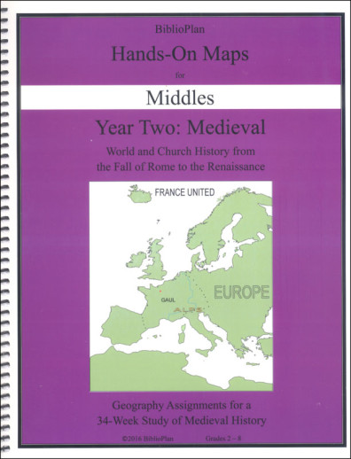
BiblioPlan Hands On Maps provides one or two full-color maps each week that correspond to the week's lesson content. Instructions for the maps are printed directly on the map. While students may need to gather a little helpful information from a world map and/or Remember the Days, Consider the Years, or the Companions, students will be able to complete the maps at their level more-or-less on their own. The same set of maps is included in both books
The Middles maps set has suggestions for K-2, 3+, and 5+ students. These maps includes some prompts and partial information that makes them easier to complete. These maps and activities correlate with the Remember the Days as well as the Companion text for the K-8 grade material.
Publisher's Description of BiblioPlan: Medieval, Renaissance & Reformation Map Packet
BP Hands-On Maps are geography workbooks that go with the lessons in Remember the Days and the Companion. Why do history students need geography workbooks? Because for BP students, geography and history go hand-in-hand. Map work shows students where history happened, and how geography can affect history.
Hands-On Maps for Middles are fun assignments for Remember the Days readers. Students complete one or two maps per week, depending on the topics covered that week. The directions are printed right on the page, which makes our maps easy to manage. A typical set of directions has students labeling countries, coloring bodies of water, and drawing symbols to show who went where.
Category Description for Biblioplan: Medieval History
Picking up where Volume 1 leaves off, BiblioPlan Medieval does some review and then delves into the fall of the Roman Empire. Year Two follows the previous format. There is one hardcover Remember the Days textbook for grades K-7, and two soft-cover Companion textbooks for grades 8-12. The 6-Units (34 weeks) of study will take your students on a historical journey around the world. Since the scope of study now includes a world view, the geography component has expanded to cover the whole globe.
From the Fall of the Roman Empire to about year 1600, unit studies include Early Christianity and the Rise of Islam, Europe and the Crusades, Asia, Exploration of the New World, the Renaissance and the Reformation, and the Elizabethan Era. Study is twofold: World History and Church History. A big focus is on Britain and France. World History will also study the Vikings, the Magna Carta, the Middle East, medieval India, the Ottoman Empire, art, science, Columbus, and the Tudor family. Within Church History learn about the first Christian martyrs to the first Christian emperor, Constantine. Study how the Church used and abused their power which led to some of the greatest Church schisms in history. You will study Christian creeds, councils, the Crusades, the Inquisition, key individuals, and the Reformation.
The Family Guide will take you step-by-step through text readings from either one of the textbooks. Further literature, audio, videos, maps, and activities are all found in individual spiral-bound books. Material found within each spiral-bound book may be reproduced for family needs. Select exactly what you want to cover with the program for each student (K-12) while studying Medieval History together.
Details
| Product Format: | Looseleaf Book |
|---|---|
| Brand: | BiblioPlan |
| Grades: | 2-8 |
| Length in Inches: | 11 |
| Width in Inches: | 9 |
| Height in Inches: | 0.5 |
| Weight in Pounds: | 0.6 |
Videos
Reviews
No Ratings
Be the first to review this item
Have a question? Ask owners.
Start typing and see existing answers.
Why did you choose this?
Looking for maps to coordinate with Exploring Planet Earth for a better rounded hands-on type of learning.
I need something simple and easy for my littles to do history with.