My Cart
0
You have no items in your shopping cart.
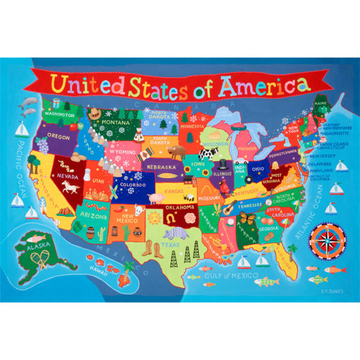
A cute, whimsical poster, this map of the United States is brightly colored with fun pictures showing characteristics of each state. The map includes labels for each state, the surrounding countries, and bodies of water. It also provides an engaging introduction to USA geography. Measures 24" x 36". ~Rachel E.
This colorful USA Wall Map measures 24?h x 36?w and will look great in any children's bedroom or classroom! It is laminated, which allows for write on/wipe off!
These 40"x 28" world and United States maps are perfect for any classroom. The U.S. map features state boundaries and capitals, while the world map displays the Mercator projection. It also includes an inset of Europe. NOTE: the world map 013434 does not include Palestine or Kosovo. Both of these maps come in full color and show time zones. Maps come rolled, in either paper or laminated versions. The Map Packs include one of each map. Now you just have to decide if you prefer paper or lamination. ~ Rachel S.