The store will not work correctly in the case when cookies are disabled.
Your company account is blocked and you cannot place orders. If you have questions, please contact your company administrator.
We use cookies to make your experience better.To comply with the new e-Privacy directive, we need to ask for your consent to set the cookies.Learn more.
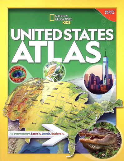
Students will learn a great deal about the United States as they read through this colorful non-consumable atlas, including key facts about each state and important statistics. Featuring more than 75 maps and 350 color photos of various state landmarks, this resource provides a wealth of information about the U.S. and even its territories. Each two-page spread features facts about the state on the left-hand page and a full-page map on the right-hand page. Each region begins with physical and political maps for that group of states. Special "fun fact" highlights and a comprehensive index also helps guide students into a deeper understanding of US geography and culture. This Atlas is nearly identical to the National Geographic Atlas item #35090, but with a slightly more economical cover. 9" x 12", 175 pgs, pb. ~ Mike
Publisher's Description of National Geographic Kids US Atlas 7th Edtn.
Celebrate America’s grandeur and diversity with more than 75 National Geographic maps, more than 350 color images, 50-plus attention-grabbing graphics, and more. Each state has its own detailed, easy-to-read map plus a brief essay, facts at a glance about population, state capital, statehood date, and the state flag, bird, and flower, as well as highlights unique to the state.
Physical maps of each geographic region make it easy to see the mountains, rivers, lakes, deserts, and prairies that make up America’s diverse landscape. Vibrant, full-color photo essays bring each region to life.
Every statistic in every fact box, every statement in every essay, and every symbol on every map has been carefully researched to ensure that the National Geographic Kids United States Atlas provides the most accurate, up-to-date information available.
Highlighting well-written books, students go deeper into historical events and people at the Intermediate level. Short writing prompts, note booking, and higher-level questions enhance learning.
Have a question? Ask owners.Have a question about this? Ask people who own it.
Start typing and see existing answers.
Instant Answers
Start typing and we'll see if it was already asked and answered.
If there aren't already some matches, submit a new question.
You'll get fast answers from customers who really own the item(s) and from our product experts. (About half the time you'll get an answer in under 2 hours!)
Good Topics To Ask About
Which items will best meet your needs
What customers who own an item think of it
How to use, fix, or take care of an item
Product information
General advice related to the types of products we sell
Our store policies
Customer Support
For questions about an order you have placed, please contact customer support directly.
2 Questions
Why did you choose this?
Rainbow Resource CenterStore
road map usa curriculum
Jessica M
best price
Susannah W
It's part of the Beautiful Feet Geography curriculum.
road map usa curriculum
best price
It's part of the Beautiful Feet Geography curriculum.
A Gentle Feast Cycle 2 book