The store will not work correctly in the case when cookies are disabled.
Your company account is blocked and you cannot place orders. If you have questions, please contact your company administrator.
We use cookies to make your experience better.To comply with the new e-Privacy directive, we need to ask for your consent to set the cookies.Learn more.
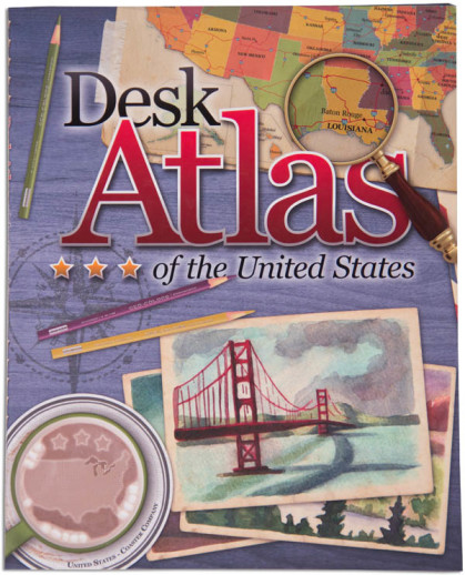
Any description of this atlas has to include a suggestion to view the sample pages online. After all, a picture is worth 1000 words! Looking at this atlas is a visual (and informational) treat. Each state (and Washington D.C.) covers a two-page spread. It has the appearance of looking like a desk blotter; with a journal open showing a map and a brief overview of the state. Surrounding the map are notes, dates, facts, illustrations and trivia "paper clipped" or "taped" in place. Readers are introduced to all of the basics: state birds, flowers, seals, flags, statistics, quarters, events, people, and much more. The maps are topographical with major cities and Interstate highways marked. Thematic maps show farm resources, expansion, population, climate and regions; and the paperback atlas ends with a state almanac and a list of geography terms defined. NOTE: there is an error on the Oregon page in reference to the zoo. Zach
Publisher's Description of Desk Atlas of the United States
The Desk Atlas of the United States is an intriguing book of maps, history, facts and symbols of each of the 50 American States.
Information for each state includes:
Summary of Climate, Geography and Features
State Quarters, Flags and Seals
Date of Statehood, Mottos and Symbols
Beautiful Physical Maps
Favorite Tourist Destinations
Features on Significant Historical Events and People
Timeline of Key Events
And Much More!
Large (9.625" x 12") full-color immersive design will inspire kids to explore our great nation.
Following the same great format as Trail Guide to World Geography, this book focuses on U.S. Geography. The thirty-six weekly lessons in this book cover the fifty states, organized by region. Students study the states at a rate of about two per week. This easy-to-teach book covers essential geographical facts and features of each state. This trail guide includes 5-minute daily drills, mapping, building a geography notebook--using the optional student notebook--and a wide variety of additional projects with research and discovery. The literature unit in this book focuses on the Lewis and Clark expedition, using the book The Captain's Dog, by Roland Smith. Heavily used resources include Uncle Josh's Outline Map Book or maps available in the Student Notebook download. Other resources are also recommended to help enhance the study. In this edition, all students use the Desk Atlas of the United States. A Geographical Terms Chart is recommended with these and all Trail Guide studies. We do not offer the chart that is recommended; however, it is available through Geography Matters. This is the 2015 update. ~ Rachel S./Rebecca G.
Have a question? Ask owners.Have a question about this? Ask people who own it.
Start typing and see existing answers.
Instant Answers
Start typing and we'll see if it was already asked and answered.
If there aren't already some matches, submit a new question.
You'll get fast answers from customers who really own the item(s) and from our product experts. (About half the time you'll get an answer in under 2 hours!)
Good Topics To Ask About
Which items will best meet your needs
What customers who own an item think of it
How to use, fix, or take care of an item
Product information
General advice related to the types of products we sell
Our store policies
Customer Support
For questions about an order you have placed, please contact customer support directly.
2 Questions
Why did you choose this?
Rainbow Resource CenterStore
required by homeschool coop teacher
Grace T
To simplify fact-finding for the GeoMatters Geography curriculum
required by homeschool coop teacher
To simplify fact-finding for the GeoMatters Geography curriculum
required
Read Through the USA