We use cookies to make your experience better. To comply with the new e-Privacy directive, we need to ask for your consent to set the cookies. Learn more.
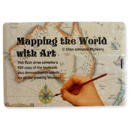
Mapping the World With Art: USB format (includes PDF Book)
This format contains everything you need on a 64 GB USB memory drive. You get a PDF copy of the textbook (you can print out any pages you'd like to), a folder of supplemental map images, and a folder with all the videos of the drawing lessons. (NOTE: You can move the files to your computer desktop, but please respect copyright and don't distribute any files to people outside of your family, classroom, or homeschool group.) As an added bonus, the drive also has about 20 GB of storage you can use!
A cursory glance through this curriculum elicits several descriptive words: detail, depth, creativity, and flexibility. Combining the history of cartography with map-making and innumerable activities, students will see the world not only as an atlas shows, but also in a way that can't be contained between the covers of a book. Drawing lessons and activities correspond to the themes of the history lessons beginning with the early days of cartography in Ancient Greece, through the discovery of Antarctica in the 1800s. Lessons are clearly presented and interesting, without using the "talking down" language that older students find annoying. Uniquely, the map activities avoid the typical "fill in the blank" templates which are usually found in geography programs. Using blank paper, students are guided step-by-step through freehand drawings of islands, countries, continents, and other geographic locations. While the drawing lessons don't have you labeling every single island, river, or mountain on the planet, the detail of the coastlines, borders, major cities, and main geographic features is such that you should be well prepared for the final project: drawing your own map of the world. Additionally, the course includes drawing lessons and over 100 pages of supplemental activities including review worksheets, games, art and craft activities, and quizzes. Covering one chapter per week, students will complete the program in one year. It is flexible, however, and may be adapted to fit your needs. Colorful and distinct, this curriculum has enough variety for both the eager and reticent cartographer. Sold in a USB Format, which includes a PDF copy of the textbook (printable) as well as a folder of supplemental map images, and a folder with all the videos of the drawing lessons. Also available is a print copy of the textbook only (no video instruction) for families who prefer a physical copy. You will need to provide art supplies such as a black waterproof pen, quality-colored pencils, card stock, calligraphy paper and pen, paint brushes, watercolor paints, and acrylic paints.
| Product Format: | Other |
|---|---|
| Brand: | Ellen McHenry's Basement Workshop |
| Grades: | 5-10 |
| ISBN: | 9781737476337 |
| Length in Inches: | 2 |
| Width in Inches: | 3.375 |
| Height in Inches: | 0.125 |
| Weight in Pounds: | 0.05 |

