We use cookies to make your experience better. To comply with the new e-Privacy directive, we need to ask for your consent to set the cookies. Learn more.
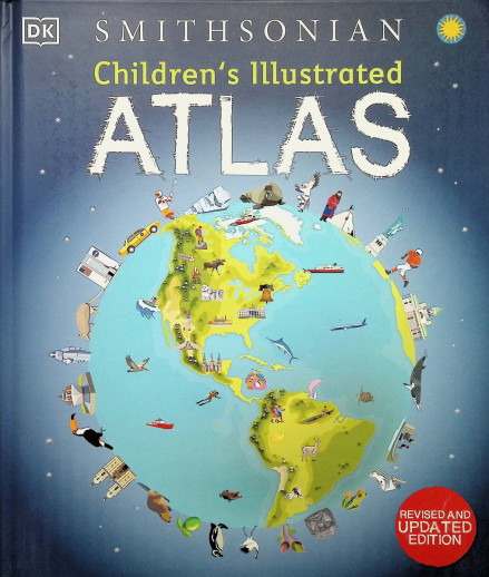
Children's Illustrated Atlas (Smithsonian) 2E
SKU
047438
ISBN
9780744073881
Grade 3-7
These icons are designed to help you quickly understand and learn important information about our products.
Teaching Method
Traditional
Teacher-centered curriculum commonly used in classrooms that may include a text, teacher manual, tests, etc.
Charlotte Mason
A methodology based on the work of a 19th century educator who maintained that children learn best from literature (Living Books), not textbooks.
Classical
A methodology based on the Latin Trivium (three stages of learning), including the grammar stage (memorization and facts), logic stage (critical thinking), and rhetoric stage (developing/defending ideas).
Unit Study
A thematic or topical approach centered around one topic that integrates multiple subject areas.
Montessori (Discovery)
A methodology based on the work of a 20th century educator that emphasizes student and sensory-driven discovery learning and real-life applications.
Other
Other methodologies
Religious Content
Secular
Contains content contrary to common Christian beliefs (i.e. evolution).
Neutral
Avoids religious or theoretical topics or presents multiple viewpoints without preference.
Christian/Religious
Faith-based or including instructional religious content.
Learning Modality
Auditory
Learns through listening, talking out loud or reading out loud.
Visual
Learns through seeing, prefers written instructions and visual materials.
Kinesthetic/Tactile (Hands-On)
Learns through moving, doing and touching.
Multi-Sensory
Curriculum that employ a variety of activities/components.
Presentation
Sequential
Curriculum progresses through well-defined learning objectives. Emphasizes mastery before moving to the next topic.
Spiral
Topics and concepts are repeated from level to level, adding more depth at each pass and connecting with review.
Conceptual/Topical
Focus is on the “why,” often with a unifying concept as well as specific skills; coverage may be broader.
Teacher Involvement
Low Teacher Involvement
Student-led materials; parent acts as a facilitator.
Medium Teacher Involvement
A mix of teacher-led time and independent student work.
High Teacher Involvement
Teacher-led lessons; may utilize discussions, hands-on activities and working together.
Additional Materials Required
No other materials needed
Everything you need is included.
Other Materials Required
There are additional required resources that are a separate purchase.
Other Materials Optional
There are additional resources mentioned or recommended but are not absolutely necessary.
Consumable
Consumable
Designed to be written in; not reusable.
Non-Consumable
Not designed to be written in; reusable.
Our Price
$19.99 $19.99 $13.95
Rainbow Savings: $6.04
Description
Using a world atlas can be overwhelming to young learners. DK/Smithsonian has taken the intimidation factor out of the equation with this lovely atlas intended just for children. This 128-page atlas is full of fun, colorful pictures on every page. Travel through North America, South America, Africa, Europe, Asia, Australasia and the Polar Regions with maps labeled for major cities, flags, places of interest, agriculture, and more. Information is presented in small paragraphs to be more reader-friendly. Every continent begins with an overview and is then broken down by country. Learn about the climate, culture, and geography of each place. Children will be able to travel the world without ever leaving home! ~ Donna
Publisher's Description of Children's Illustrated Atlas (Smithsonian) 2E
Set off on a thrilling journey around the world in this incredible atlas for kids – packed full of beautiful illustrations and photographs.
Discover the world map-by-map with this exciting world atlas book for children, featuring more than 50 maps! Each page is filled with fascinating information, facts and colorful illustrations of our world.
Children aged 7-9 will love to learn all about the many countries, cultures, people and animals of the world through vibrant maps. Each map is bursting with information, combining colorful icons with photographs representing key points about each country. The atlas also includes a world map poster, with a political map for each continent – and children are shown how to read a map and use a key, compass, and scale!
Inside the pages of this atlas book for children, you’ll find:
– Information that supports the curriculum, with colorful icons and photographs that show people and places, animals, food, historical sites, industry, and habitats.
– More than 50 specially commissioned maps of the world featuring countries and continents in full-color detail.
– Bite-sized facts and figures about each country making it easy for children to understand.
– Diagrams that compare climates, population, mountains and rivers, famous sites, and natural wonders of the world.
Children’s Illustrated Atlas brings the world to life with vivid maps and fascinating facts about the countries of the world, making it the perfect gift for little geographers. This charming and informative book is a key addition to every child’s library.
Details
| Product Format: | Hardcover |
|---|---|
| Grades: | 3-7 |
| Brand: | Dorling Kindersley |
| ISBN: | 9780744073881 |
| Length in Inches: | 12.125 |
| Width in Inches: | 10.25 |
| Height in Inches: | 0.625 |
| Weight in Pounds: | 2.2 |
Videos
Reviews
No Ratings
Be the first to review this item
Have a question? Ask owners.
Start typing and see existing answers.
Why did you choose this?
Chosen b/c it's part of Torchlight Level K
I am hoping this book will spark interest in geography for my children.
Looks like a great resource. I bought the Junior Classroom Atlas but need something with a little more substance to go along with it.
Hoping it will be a good resource for geography