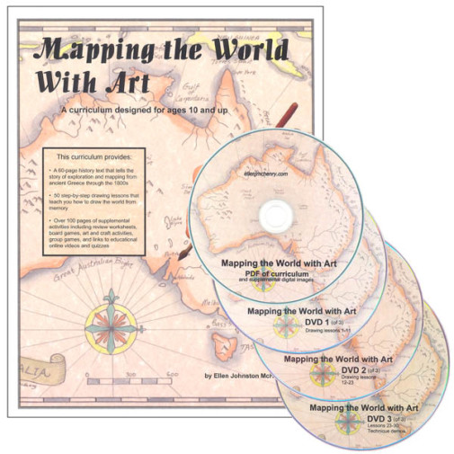
Mapping the World With Art Book w/ CD, DVDs

SKU
046829
Grade 5-10
Teaching Method
Traditional
Teacher-centered curriculum commonly used in classrooms that may include a text, teacher manual, tests, etc.
Charlotte Mason
A methodology based on the work of a 19th century educator who maintained that children learn best from literature (Living Books), not textbooks.
Classical
A methodology based on the Latin Trivium (three stages of learning), including the grammar stage (memorization and facts), logic stage (critical thinking), and rhetoric stage (developing/defending ideas).
Unit Study
A thematic or topical approach centered around one topic that integrates multiple subject areas.
Montessori (Discovery)
A methodology based on the work of a 20th century educator that emphasizes student and sensory-driven discovery learning and real-life applications.
Other
Other methodologies
Religious Content
Secular
Contains content contrary to common Christian beliefs (i.e. evolution).
Neutral
Avoids religious or theoretical topics or presents multiple viewpoints without preference.
Christian/Religious
Faith-based or including instructional religious content.
Learning Modality
Auditory
Learns through listening, talking out loud or reading out loud.
Visual
Learns through seeing, prefers written instructions and visual materials.
Kinesthetic/Tactile (Hands-On)
Learns through moving, doing and touching.
Multi-Sensory
Curriculum that employ a variety of activities/components.
Presentation
Sequential
Curriculum progresses through well-defined learning objectives. Emphasizes mastery before moving to the next topic.
Spiral
Topics and concepts are repeated from level to level, adding more depth at each pass and connecting with review.
Conceptual/Topical
Focus is on the “why,” often with a unifying concept as well as specific skills; coverage may be broader.
Teacher Involvement
Low Teacher Involvement
Student-led materials; parent acts as a facilitator.
Medium Teacher Involvement
A mix of teacher-led time and independent student work.
High Teacher Involvement
Teacher-led lessons; may utilize discussions, hands-on activities and working together.
Additional Materials Required
No other materials needed
Everything you need is included.
Other Materials Required
There are additional required resources that are a separate purchase.
Other Materials Optional
There are additional resources mentioned or recommended but are not absolutely necessary.
Consumable
Consumable
Designed to be written in; not reusable.
Non-Consumable
Not designed to be written in; reusable.
Rated 4.83 out of 5
Read 6 Reviews|7 Questions, 64 Answersor
Our Price
$49.95 $49.95 $45.95
Rainbow Savings: $4.00
Description

A cursory glance through this curriculum elicits several descriptive words: detail, depth, creativity, and flexibility. This course combines a textual history of maps and map-making with innumerable activities. Through hand-drawn and edible maps, star charts and video documentaries, games and watercolors, students will see the world portrayed not only as an atlas shows it but also in a way that can't be contained between the covers of a book. There are 60 pages of historical readings (well illustrated with photos, maps, and drawings) which chronicle exploration and mapping from the time of the earliest maps through the 1800s. Accompanying these readings are 90 pages of drawing lessons that guide students step-by-step through freehand drawings of islands, countries, continents, and other geographic locales. There are also over 100 pages of supplemental activities including review worksheets, games, art and craft activities, links to online videos (map projections, virtual tours of globe factories, bios of explorers, etc.), and quizzes. Additional resources supplied with the book are DVDs that contain actual drawing lessons for the map drawing activities and a printable PDF version of the curriculum. While the drawing lessons don't have you labeling every single island, river, or mountain on the planet, the detail of the coastlines, borders, major cities, and main geographic features is such that you should be well prepared for the final project: drawing your own map of the world. Colorful and distinct, this curriculum has enough variance for both the eager and reticent cartographer.

Details
More Information
Product Format:Ring Bound Book with CD
Grades:5-10
Brand:Ellen McHenry's Basement Workshop
Author:Ellen Johnston McHenry
Length in Inches:11
Width in Inches:8.5
Height in Inches:1
Weight in Pounds:1.85
Videos
This product doesn't have a video
Reviews
6 Ratings
4.8out of 5 stars
6 Ratings

Rated 5 stars by 83% of reviewers

Rated 4 stars by 17% of reviewers

Rated 3 stars by 0% of reviewers

Rated 2 stars by 0% of reviewers

Rated 1 star by 0% of reviewers

6 Reviews
Rated 4 out of 5
Oct 7, 2020
Geog, history and art, all in one.
My son has found this product fun and easy. He enjoys the instructors guidance and the stories that give the history behind the maps.
Rated 5 out of 5
Aug 24, 2018
Engaging, Short, & Sweet
Great course. Easy to use, as well as able to use on multiple grade levels at one time.
Rated 5 out of 5
Jul 9, 2018
Great way for kids who enjoy art to learn geography
My son didn't care for the history lessons at the front of the book, but I found them interesting. He enjoyed all of the drawing lessons and remembers the actual shapes of various locations so much better than my older kids who simply memorized maps. We both really enjoyed the projects in the back of the book -- especially drawing fancy compass roses and making antique-looking maps!
Rated 5 out of 5
Aug 11, 2017
used for co-op class
used this is a 20 week co-op. It has 30 lessons so it wasnt the best fit trying to compress it, but the kids enjoyed and so did I. There are readings, activities, and then drawing out the area for each lesson. At the end, we had them all draw a map of the world. It does not include political lines, more general areas. Like no states, just North America and South America. some of the European countries are drawn separately, but not all. its harder in a group because of them all trying to see the drawing lesson. I would think a group of maybe 8 or less. We had about 15.
Rated 5 out of 5
Sep 10, 2016
Love it!
The curriculum is easy to use. My children enjoy the readings and love drawing the maps! (Even my children who are not so crazy about art.) We bought the DVDs and they are very helpful.
Rated 5 out of 5
Aug 30, 2013
I researched quite a few World Geography programs before finally purchasing Ellen Mc Henry's "Mapping the World with Art" It was an extremely successful purchase decision that I most highly recommend I am using it in a large homeschool co-op setting for approximately 20 middle and high school students Almost each drawing is associated with some sort of memorable character that it could be imagined to look like by association to help remember it's name and location Each lesson has it's corresponding history reading giving lots of information about early exploration and navigators of the globe as well as map making and navigating with astronomy The kids stayed engaged and connected with the material all the way through each drawing We loved the additional art projects such as antique parchment maps painting and model activities which make great keepsakes especially if framed The map drawing practice worksheets video links making South America and Africa cookies (recipe included) all have been enriching and fun There are also very helpful grid set ups and spotting points continually reviewed to help with accurate proportion and spacing in drawing the world map to scale There is a lot of attention given to where geographic locations are in relation to the equator Tropic of Cancer and Tropic of Capricorn Used in conjunction with the notebook materials the DVD's show a step-by-step approx 15 minute video tutorial done personally by the notebook's author/inventor Ellen Mc Henry for each of the 30 map drawing lessons presented for the most in-experienced at drawing The 30 lesson schedule plus the final world map project worked out perfectly in a large group setting for me and my group The drawing tutorials worked out perfectly to fill our 50 minute time slot once a week with a group of that size even with lots of pausing Get this curriculum and your kids will end up with a tremendous retention of all of the countries and continents of the world and the early explorers who discovered and mapped it It's all packaged neatly and easy to open and go all while having fun and staying challenged I plan on using this curriculum again in future years to come with our homeschool group!
Product Q&A
Have a question? Ask owners.Have a question about this? Ask people who own it.
Start typing and see existing answers.
7 Questions
Why did you choose this?

Ellen McHenry's Basement Workshop videos & materials are excellent!

It is important for children to know geography.

I have a visual and kinesthetic learner

Saw this at a homeschool convention several years ago while my kids were too young and have come back to it.

How much time per lesson is required? I see lessons and above people mentioning how they structured this course into their week…how much time did the readings take per week?

My 12 year old son was doing this on his own. He likes maps and technical drawing, and is a good reader. He usually had a 45 minute time allowance, once a week, and he did not need all of that for the reading. Maybe 10 minutes to read and the rest of the time to make the map…. Hope that helps.

How many minutes long is each lesson? I am considering it for a co-op class. Thanks!

It depends on how you use the book. On Monday, we read the lesson (1-3 pages long), then walk through how to draw the map. Tuesday-Thursday she draws the map 3x on her own to set in her memory. On Friday, we do the activity. The activity can take 30-60 minutes depending on what is called for that week. The activities are super fun and do a great job of reinforcing the map work, as well as provide a lot of additional information.
For a co-op, if the kids did the map drawing on their own and then come together once a week for the activity, you should easily have time for the activities during class.

I have a soon to be 9th grader who has expressed interest in this. Could it be counted as a half credit of geography or would it need to be supplemented?

I agree, this can definitely be counted as a half credit in geography. I have actually added watching Geography Now videos on Youtube and and The Great Courses World History: The Fertile Crescent to The American Revolution DVDs along with Mapping the World with Art to make this a full credit of World Geography & World History. This way, my student learns the geography of an area, the history of that area, and the current social studies of that area.

Is the text still in binder form, or in paperback?

It is in paperback, but the entire text is also on a CD that could be printed out for binder form if desired.

How is Mapping the World with Art different than Mapping the World by Heart?

Mapping the world with Art has the kids actually drawing the entire globe with easy to follow drawing directions. Some kids like to use the DVDs to watch the author instruct how to do the drawings, but the directions in the book were very easy for my sixth grader to follow on his own. He really gained a great sense of the shapes and proportions on the globe, and we "saw" in detail the coast lines of places you rarely look at on a map such as the coastlines in the Arctic circle.Mapping the World by Heart is less artistic, more just labelling and memorizing locations. It was definitely less user-friendly, and none of the stories about the history of exploration and map-making.

I have the Mapping the world with art book. Is there anyway I can get just the dvd?

Yes, you can order directly from the authors website. just do a search on Mapping the World with Art.