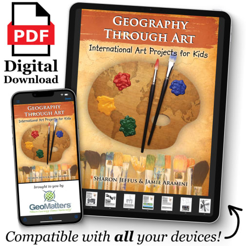
As you are blazing a trail around the world in your geography studies, take some time to appreciate the art and artists from the locations you are studying. This internet-linked text will have you making mosaics in Russia, dot painting with the Aboriginals, and quick sketching about culturally relevant subjects. Projects are leveled for students based on difficulty, templates and maps are reproducible, material lists are provided, and additional resources are found throughout. This material would make an excellent supplement to any geography study. PDF downloads are available on any device that has Acrobat Reader capabilities. ~Rebecca
Geography Through Art - Digital Download
Product Overview
Description
Geography Through Art is the ultimate book of international art projects. Join your children on an artistic journey to more than twenty-five countries spanning six continents. This Internet-linked book includes a variety of project types, from watercolor to paper mache to sculpting and more.
Features include: Quick Sketch: assignments with step-by-step examples; Artist Profile: bios of famous artist's contribution to society; Culture Connection: commonalities of art in different cultures; Materials Lists: included with every project; Geography Summaries; Reproducible Maps and Templates; Student Level Ratings; Internet linked for in-depth study opportunities; Recipe references to Eat Your Way Around the World.
Use this book as an exciting way to supplement any study of geography, history, or social studies. Geography Through Art is sure to make a lasting addition to your home or school library. You'll find yourself reaching for this indispensable guide again and again to delight and engage students in learning about geography through the culture and art of peoples around the world.
Here are just a few of the exciting projects inside: Russian Mosaics; Polish Paper Cutting; Australian Didgeridoos; Indian Batik; Japanese Fish Printing; Chinese Scrolls; Aboriginal Dot Painting; Stained Glass Windows; Pennsylvania Dutch Fraktur;Tagua Nut Carvings.
Recommended resource for: Trail Guide to World Geography; Trail Guide to U.S. Geography; and Eat Your Way Around the World.
The Trail Guide to World Geography blazes a trail through geography - all you have to do is follow it! Author Cindy Wiggers has done a terrific job of combining questions, mapping, and other activities into a fun, easy-to-teach approach to geography. Intended as a 36-week program, the first 27 of these include a variety of activities. The first weeks encompass the world as a whole; then you focus on different regions continent by continent. Within each week there are several different methods of learning. One of these, Geography Trails, provides questions four days a week that will improve the student's ability to use maps to locate countries, capitals, bodies of water, and landforms, teach them valuable geography terms and learn many geography facts. Different questions are given for grades 2-4, 5-7, and 8-10, so that you can use this book for children at different levels at the same time. Additional geography activities for every week are in the form of "Points of Interest," where you can take time to learn more extensively. Activities to choose from include mapping, researching, suggestions for art projects, and weekly projects to compile into your very own geography notebook. Then it's geography through literature for the last nine weeks as you read through Around the World in 80 Days. Questions for each chapter are provided, as are ideas for additional research and spelling and vocabulary words.
Please note that that this course provides a framework for studying world geography, and relies on additional resources for reference, maps, and activities. Required resources include: Around the World in 80 Days by Jules Verne if you are planning on completing the literature portion of the study and an age-appropriate world atlas, Suggested atlases are listed below. Three "key" recommended resources you will rely heavily on for many of the activities include the Ultimate Geography and Timeline Guide, Uncle Josh's Map Book (in book form, or CD-ROM), and Visual Manna's Teaching Geography Through Art (for the art in geography lessons). Although you could make the study work without these, they are often referred to in the lessons, and the program would work much more easily with them. These and other recommended resources are listed below, including atlases for students of different grades. Please note that the Jr. Classroom Atlas and Classroom Atlas are identical to the World Atlas Know Geography (Grades 1-3 and 4-9), respectively. The Atlas of World Geography and the World Atlas Know Geography for high school are almost identical with just a few textual changes. An almanac is also recommended, in case you don't have one on hand, we recommend the World Almanac & Book of Facts. A Geographical Terms chart is also recommended; we are unable to offer this specific one, but it is available from Geography Matters.
Uncle Josh's Outline Map Book is a valuable resource book that contains over 130 reproducible maps (each of the fifty states, continents, ancient historical regions, and more). Uncle Josh's Outline Map Collection, in CD-ROM format, contains over 260 printable maps (including all those in the book). Requirements: Windows 95 or later; OS 9 or later; Acrobat 5.0 or above (included); and an inkjet or laser printed (recommended). Both sets are also available in digital download format. ~Stephanie
| Product Format: | Other |
|---|---|
| Grades: | K-12 |
| Brand: | Geography Matters |
| EAN/UPC: | GM-GTAe |

