We use cookies to make your experience better. To comply with the new e-Privacy directive, we need to ask for your consent to set the cookies. Learn more.
New York State Map Chart (11" x 17")
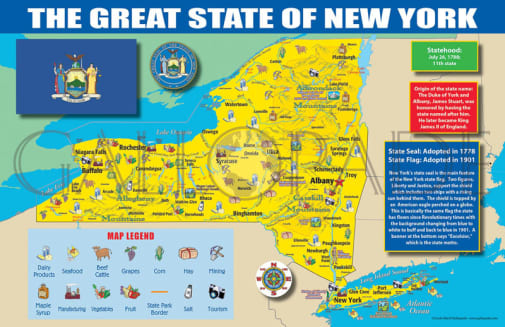
The New York State Map is great for building map literacy. Students will be able to reference the map of New York all year long!
The map includes:
• A colorful map of New York that includes all the major cities
• A map legend that includes where all the major industries are located throughout the state (Berries, Cattle, Corn, Dairy, Fruit, Hay, High-tech Industry, Mining, Nursey Products, Poultry, Seafood, Tourism, Vegetables)
• Origin of New York's name
• History of New York's flag and image of the flag
• New York's statehood date
• New York state seal
Each map is 11" X 17" and printed cardstock.
Large cities, rivers, lakes, and state resources are labeled on these maps. Also includes illustrations of state birds, flowers, trees, and flags. Displays important dates, as well as other interesting information. Posters are colorful and made on thick paper. Perfect to display for easy reference. Poster measures 11" x 17". ~ Rachel
Product Format: | Softcover Book |
---|---|
Brand: | Gallopade International |
Grades: | PK-AD |
ISBN: | 9780635132666 |
Length in Inches: | 11 |
Width in Inches: | 17 |
Height in Inches: | 0.0625 |
Weight in Pounds: | 0.05 |