The store will not work correctly in the case when cookies are disabled.
Your company account is blocked and you cannot place orders. If you have questions, please contact your company administrator.
We use cookies to make your experience better.To comply with the new e-Privacy directive, we need to ask for your consent to set the cookies.Learn more.
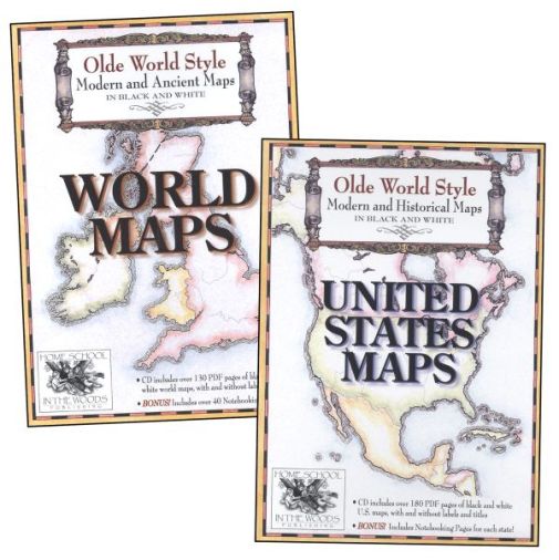
The details in these maps are absolutely stunning The folks at Home School In The Woods have taken the time to create a quality product to help you teach geography The first map I printed was CANADA obviously and my son who is 9 was all excited to practice learning the provinces and territories of our country He even did more than I asked him to do and learned the countries surrounding Canada seas bays and rivers on the map as well I was even more impressed with this product when I realized that you could also get some interesting pages related to the theme of the products For example in the Old World Style Modern and Ancient Maps: World Maps you would find recipe cards flags special identification graphics for the countries geography terminology to learn flora and fauna history timeline and so much more! You will also get the maps from ancient Egypt ancient Greece the voyages of Paul Palestine time when Jesus came and so on However in the Old World Style Modern and Historical Maps: United States you will be able to get the State Facts pages to write down information about all the various states This would be very fun to do when we go on a trip in the US with our RV Two years ago we went to PA MA ME before heading to NB and PE in Canada Consequently I am thinking of starting a project with my oldest son so he can keep track which states we have visited in a notebook These pages are simply wonderful! My only regret is that there aren't pages for the different provinces and territories of Canada like the ones for the various states in the US I personally think it would be a great addition Why not create an Olde Word Style Modern and Historical Maps: CANADA After all we have a lot of history in our land and to think that Nunavut is a territory only since 1999 It would be very interesting to have the progression of Canada on maps with this concept And we could include pages for Canadian recipes from natives as well as French Canadians and immigrants in the country Dont you think it would be a great idea? And with the number of homeschoolers in Canada I am sure that this would be a product that will be popular among us CanadiansIn conclusion I absolutely recommend these products for anyone who wants to discover geography with their children They are well done and fun to use I know that these products will be used a lot in our household and in our trips The world is right at our fingertips!
Have a question? Ask owners.Have a question about this? Ask people who own it.
Start typing and see existing answers.
Instant Answers
Start typing and we'll see if it was already asked and answered.
If there aren't already some matches, submit a new question.
You'll get fast answers from customers who really own the item(s) and from our product experts. (About half the time you'll get an answer in under 2 hours!)
Good Topics To Ask About
Which items will best meet your needs
What customers who own an item think of it
How to use, fix, or take care of an item
Product information
General advice related to the types of products we sell
Our store policies
Customer Support
For questions about an order you have placed, please contact customer support directly.
1 Question
Why did you choose this?
Rainbow Resource CenterStore
For Homeschooling Use
Heather Z
I want to have history and geography tied together. Seeing where the places are helps visualize what is being learned. I used the US maps years ago (needed to repurchase for last child). We loved…
Janet B
I love the looks of these maps and they will work well with the Record of Time we are purchasing. My girls love maps, and I think they will enjoy adding details to these. Gorgeous presentation.
For Homeschooling Use
I want to have history and geography tied together. Seeing where the places are helps visualize what is being learned. I used the US maps years ago (needed to repurchase for last child). We loved…
I love the looks of these maps and they will work well with the Record of Time we are purchasing. My girls love maps, and I think they will enjoy adding details to these. Gorgeous presentation.